
 Buy Now with

About Islamic World Geography 2
Geography, or the science of the earth, is the study of the human environment; in other words, geography is the science that discusses the earth's surface, natural phenomena, climate, vegetation, soil, products, and the like, their distribution across the earth, and their relationship with humans. Each element studied in this science gives rise to a specialized branch, such as: geology, meteorology, astronomy, anthropology, biology, and more.
This Arabized word, as a science studying the earth's surface as a human habitat, is derived from the Greek compound word "Geo" meaning earth, and "Graphing" meaning writing and recording, first used by the Greek scholar Eratosthenes (273–192 BC). The term "Geography" (Jaoghrafia, etc.), which was the title of works by Marinus of Tyre (c. 70–132 AD) and Claudius Ptolemy (c. 90–168 AD), was translated into Arabic as "Surat al-Ard" (Image of the Earth) and became the title for some works by Muslim geographers. Al-Mas'udi (d. 346 AH) interpreted this term as "Qat' al-Ard" (traversing the earth). In any case, this term was first used in the "Epistles of the Brethren of Purity" to mean "Map of the World and Climates".
This science, known among Muslim scholars as "Surat al-Ard" and "Qat' al-Ard" (surveying the earth), was closely and deeply connected with determining locations, knowing routes, measuring land, surveying, and cartography. The emergence of Islam and its rapid expansion marked a turning point in the development of geographical science; especially since the Islamic religion provided a strong incentive for attention to and growth of this science. The Holy Quran introduced Muslims to the fundamentals of geography by mentioning topics regarding the creation of the universe, night and day, the movements of the sun, moon, and planets, as well as the world's waters and lands. Furthermore, the Quran's references to past nations and their remaining ruins encouraged Muslims to travel and gather information about past civilizations, just as the Hajj pilgrimage became the greatest motivation for learning about Masalik (routes) and Mamalik (cities and settlements). The early Islamic conquests also familiarized Muslims with many cities and countries; meanwhile, the administration and protection of Islamic lands necessitated gathering necessary information about populations, wealth resources, and communication routes, greatly aiding the expansion of geographical science among Muslims. Muslims, in addition to their own experiences, appended geographical sciences and information from other civilizations and peoples such as India, Iran, and Greece, thereby adding to the perfection and richness of this science.
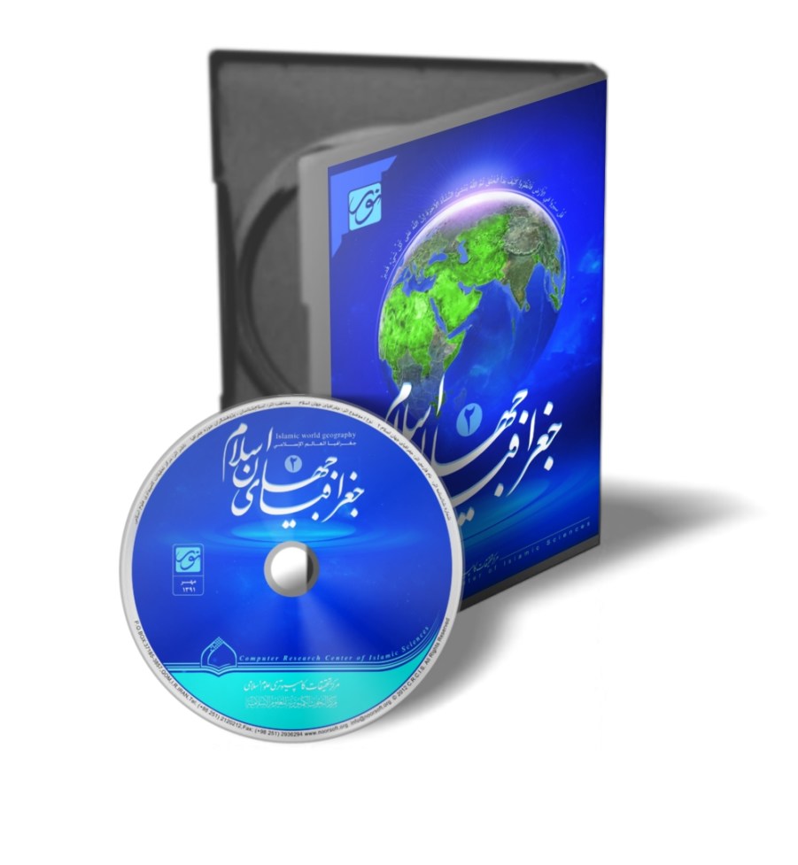
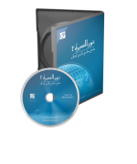
The present library, named "Geography 2," is a collection of ancient and modern sources related to this discipline, including knowledge of Masalik (routes), Mamalik (cities), shrines of scholars and notables, travelogues, geographical dictionaries, and maps.
Standardizing places with a specialized format, providing maps, and the ability to link places to maps are features of this software. Since geography is a tool for better understanding other sciences, this software can complement other Center programs, especially historical ones such as: "Noor al-Seerah," "History of Shi'ism," "History of Iran," "Seerah of the Infallibles," and other programs produced by this Center.
Geographical Science and its Evolution
• Geography in Ancient Iran
We do not have much information about the research and investigation of ancient Iranians in geography. The oldest available document in this regard is the remaining parts of the Avesta, which in some sections refer to the status or names of certain lands, seas, mountains, and rivers. In the first Fargard of the Vendidad book, sixteen lands created by "Ahura Mazda" are mentioned, but since the scientific parts of the Avesta have been lost, no further information is available. Afterward, in the Behistun inscription, we encounter the names of countries that Darius claimed to rule, and similar brief and partial information is observed in some Greek writings. From the Sassanian era, in addition to scattered fragments found within some books of that period, an independent book titled "Shahrestan-haye Iranshahr" (Cities of Iranshahr) is available, which lists names and brief descriptions of Iranian cities and some legendary narratives about them; it has also been translated into Persian.
• Geography in Islamic Civilization
Muslims did not know geography as a science with a clear definition, limits, framework, and specific content as it is today. Muslim geographical texts were scattered among numerous sciences, and independent treatises written on various aspects of geography bore titles such as "Kitab al-Buldan" (Book of Countries), "Surat al-Ard" (Image of the Earth), "Al-Masalik wa al-Mamalik" (Routes and Kingdoms), "Ilm al-Turuq" (Science of Routes), and the like.
According to Abu Rayhan al-Biruni, "Al-Masalik" was a science concerned with determining the geographical location of places. Al-Maqdisi, in his book "Ahsan al-Taqasim fi Ma'rifat al-Aqalim" (The Best Divisions for Knowledge of the Regions), approached most aspects of geography. The modern use of the term "Geography" in the Arabic language is a relatively recent development.
Before Islam, geographical knowledge among Arabs was limited to some traditional and ancient geographical concepts or the names of places in Arabia and neighboring lands. Many of these concepts must have originated in Babylon in ancient times or been based on Jewish and Christian traditions and local Arab sources.
• Development of Geography
After the advent of Islam, as mentioned earlier, the Holy Quran introduced Muslims to the fundamentals of geography by mentioning topics regarding the creation of the universe, night and day, the movements of the sun, moon, and planets, as well as the world's waters and lands. Furthermore, the Quran's references to past nations and their remaining ruins encouraged Muslims to travel and gather information about past civilizations.
The Hajj pilgrimage, obligatory for every capable Muslim, itself created the greatest motivation for learning about Masalik (routes) and Mamalik (cities and settlements). The gathering of thousands of pilgrims from all corners of the Islamic world in Mecca provided vast knowledge about geographical conditions, lifestyles, social situations, and customs of Muslims worldwide. The successful conquests of the early decades and centuries caused the religion of Islam to spread from the Atlantic coasts in Europe and Africa in the west to the land of India in the east, and from Central Asia and the coasts of the Black and Caspian Seas in the north to Abyssinia and the Great Sahara in Africa in the south, encompassing a major part of the known world at that time. In this vast region, diverse climates and geographical conditions prevailed, providing abundant geographical information; meanwhile, the administration and protection of Islamic lands made it necessary to gather required information about populations, wealth resources, communication routes, and generally the geographical conditions of Islamic territories. The political expansion of Muslims in Africa and Asia gave them the opportunity to collect information and record their experiences and observations of lands under their control or neighboring the Muslim Empire. Whether such information was collected for military campaigns or other purposes, it was likely used in the "Description of the Earth" writings of the early Abbasid period.
The sum of the aforementioned factors brought about significant development in geographical information, and geographical science flourished in the Islamic world. With the establishment of the Abbasid government in Baghdad in 132 AH, and based on the aforementioned factors, activities took place in the sciences, especially geography. The conquest of Iran, Egypt, and Sindh gave Muslims the opportunity to gain first-hand information from the scientific and cultural achievements of the peoples of these three cradles of civilization, or to easily access their scientific centers, laboratories, and observatories. In Baghdad, the "Bayt al-Hikmah" (House of Wisdom) was established, where translators engaged in translating scientific books. The translators were often distinguished scholars themselves, whose efforts enriched the Arabic language with geographical, astronomical, and philosophical knowledge from India, Iran, and Greece. Among the geographical books translated from Greek to Arabic during this period was Ptolemy's "Geography," which the great Muslim scholar Al-Khwarizmi (d. after 232 AH) translated into Arabic. Through these translations, Muslims became familiar with basic geographical concepts such as the shape and movements of the earth, divisions of longitude and latitude, the movement of celestial bodies, and other topics of mathematical geography. They also benefited from Eastern sources (Indian, Iranian, Sanskrit) and gradually added to the richness of geographical concepts.
Indian geographical and astronomical knowledge entered Arabic geographical literature through the first translation of the Sanskrit book "Siddhanta." This book was translated into Arabic during the reign of Al-Mansur al-Abbasi (r. 136–158 AH) and became the foundation of Muslim knowledge in astronomy and geography.
Among the topics Muslims learned from Indians were: the rotation of the earth on its axis, the ratio of water to land on the globe as half to half, the resemblance of the earth's landmasses to a turtle surrounded by water on all sides, and human habitation in the Northern Hemisphere.
• Geographical Knowledge of Iranians
The influence of Iranian geographical knowledge in the Islamic world was greater than elsewhere, due to the existence of Gundishapur in Iran, which was a major center of knowledge and research. Muslims became familiar with Pahlavi works in astronomy, geography, and history through translations, and likely, due to their early conquests, acquired extensive information about the Sassanian Empire and its administrative divisions. Among the important geographical concepts adopted and used by Muslims from Iranians was the concept of the "Seven Climates" (Haft Keshvar), where the world was divided into seven equal geometric circles, each constituting a country. Iranian traditions also had a profound influence on Muslim texts regarding maritime trade and navigation; the presence of words like "Bandar" (port), "Nakhoda" (ship captain), "Rahnameh" (guidebook), and the like in Arabic geographical literature indicates this. Iranian influence on Muslim cartography is also evident, evidenced by the use of terms such as "Taylasan," "Shaburah," "Qawwarah," etc., in describing coasts, as well as statements by Muslim geographers about maps based on the Iranian system of administrative divisions.
• Geographical Knowledge of Greeks
Greek geographical knowledge reached Muslims primarily through the translation of Ptolemy's "Geography." This book was translated into Arabic several times during the Abbasid Caliphate; what remains is Al-Khwarizmi's translation. Among these translations is that of Abu al-Hasan Thabit ibn Qurrah (d. 288 AH), and apparently, Ibn Khurdadbeh also had access to a translation of Ptolemy's book. In addition to Ptolemy's "Geography," his other books were also translated into Arabic, marking the beginning of a scientific transformation in astronomy and geography. Although Iranian influence in regional and descriptive geography, as well as in cartography, was significant, the scientific and philosophical influence of Greece in mathematical, natural, human, and biological geography within the framework of Ptolemaic concepts was more enduring in Islamic geography, to the extent that it can be said to have persisted for a thousand years (until the 13th century), with its effects visible in Persian geographical writings and even Urdu writings produced in India. Meanwhile, Muslim geographers of later centuries repeatedly doubted and corrected Ptolemaic concepts; at the same time, some geographers strove to reconcile Ptolemaic geographical principles with the Quran, Hadith, and Islamic rulings; for example, Al-Biruni criticized Ptolemy's measurements of meridians.
• Geographical Knowledge of Arabs
Between the caliphate of Al-Mansur (136–158 AH) and Al-Ma'mun al-Abbasi (198–218 AH), a huge transformation occurred in the geographical thinking of Muslim scholars; topics such as the sphericity of the earth and its position at the center of the universe were accepted, and attention was paid to Quranic verses and Hadiths regarding the creation of the universe, heaven, and earth, with the aim of religiously validating geographical works to encourage Muslims to study geography and astronomy (see, for example, Ibn al-Faqih, pp. 3–7; Al-Maqdisi, pp. 14–19). Thus, the real foundation for compiling geographical works was laid in the early third century. The first positive step in this regard was taken during the time of Al-Ma'mun, as he was interested in astronomy and geography. During his reign, means were provided for translating many books from various languages, and by his order, Muslim geographers and astronomers measured one degree of geographical latitude on the meridian arc in the flat plain of Sinjar (in Syria) with amazing accuracy. According to Nallino, this action by Muslims was the first real measurement of the equator. Also, the map of the known world was drawn as "Al-Surah Al-Ma'muniyah," which, according to Al-Mas'udi, surpassed the maps of Ptolemy and Marinus. These scientific achievements by Muslims, especially in measurements and cartography which were more accurate than their predecessors, occurred at the beginning of two fruitful centuries (the third and fourth), which should be called the Golden Age of Islamic Geography, as enduring scientific works in Islamic geography emerged during these two centuries, serving as guides and references for geographers for years.
The works of Greek writers, astronomers, and philosophers, after being translated into Arabic, helped Islamic geography to transform based on scientific principles. Among the prominent Muslim astronomers and philosophers whose works geographers utilized were Ya'qub ibn Ishaq al-Kindi (d. 260 AH), who wrote the book "Rasm al-Ma'mur min al-Ard" (Drawing of the Inhabited Earth), and his student Ahmad ibn Muhammad ibn Tayyib al-Sarakhsi (d. 286 AH), who authored "Al-Masalik wa al-Mamalik." Their writings have been lost, and what is said about them is derived from sources that utilized those works. Arram ibn Asbagh al-Sulami, a famous author of the first half of the third century, wrote two books: "Jazirat al-Arab" and "Asma' Jibal Tahama wa Makanuha"; the latter concerns the mountains of Tahama in Arabia.
In the third and fourth centuries, numerous geographical books were authored in Arabic. It appears their authors had sources in the Pahlavi language regarding the Sassanian Empire, and in some cases, they had direct involvement in administrative and executive tasks, such as serving as scribes in the chancellery or supervising the postal administration (Barid). These works typically covered general geography topics and were authored under the title "Al-Masalik wa al-Mamalik"; among them is "Al-Masalik wa al-Mamalik" by Ibn Khurdadbeh, which became a basis and model for writers of general geography. These works are divided into two main types or two intellectual schools:
1. The Iraqi School
Works related to this school were written about the world in general, but the Abbasid government with its capital Baghdad or the Islamic world was described in greater detail, such as the works of Ibn Khurdadbeh, Al-Ya'qubi, Ibn al-Faqih, Qudamah ibn Ja'far, and Al-Mas'udi. Since these individuals belonged to Iraq, which was the center of geographical education, they became known as followers of the Iraqi School. One characteristic of this school's followers is that some considered Baghdad the center of the world, while others considered Mecca; another is that they organized their content based on dividing the world into four parts: North, East, South, and West. Regarding this, Al-Mas'udi said: "The Persians divided the inhabited part of the world into four parts: Khurasan (East); Bakhtar (North); Khurbaran (West); and Nimruz (South)."
2. The Balkhi School
In works belonging to this school, great emphasis was placed on the Abbasid domain within the Islamic world, with little attention paid to regions outside the sphere of Islamic influence, such as the works of Al-Istakhri, Ibn Hawqal, and Al-Maqdisi. These individuals were followers of Abu Zayd Ahmad ibn Sahl al-Balkhi, and accordingly, their school was named the Balkhi School. Followers of this school gave a more Islamic color to Muslim geography, as they mostly limited their discussion to Islamic lands. They considered Mecca the center of the world and began their writings with a description of Mecca. Their method of dividing the Islamic world was neither Iranian (based on countries) nor Greek (based on climates), but based on Islamic lands, which was a significant innovation and advancement compared to previous methods. Another merit of this group's work was their innovation in cartography; thus, a separate map was drawn for each section, observing principles of perspective and distinguishing regions by presenting borders and other geographical information. This is considered the first experience in Islamic cartography. Al-Istakhri, Ibn Hawqal, and Al-Maqdisi, who are regarded as the pillars of this intellectual school in Islamic geography, showed kingdoms with geographical definitions in their maps for the first time, and the collection of maps included in their books is among the most exquisite of its kind.
Target Audience of the Present Software
Researchers in all fields of humanities are the general audience of this software and will benefit from it, but students of disciplines such as history and historical geography, due to their extensive and continuous connection with geography, are its specific audience.
- Scopes
A) Temporal Scope:
Priority was given to ancient texts, and geographical sources from the dawn of Islam up to the Qajar era have been collected and presented as much as possible. Prominent examples from modern research were also considered, such as: "The Historical Geography of the Eastern Caliphate Lands" by Le Strange, "Turkestan Nameh" by Barthold, "Isfahan" by Lotfollah Honarfar, etc.
B) Content Scope:
As defined, the content of books in this program includes books on Masalik (routes), Mamalik (cities), shrines of scholars and notables, travelogues, geographical dictionaries, some books on the history of cities and regions authored with a geographical perspective, and maps.
C) Linguistic Scope:
The sources used are in Persian and Arabic.
D) Geographical Scope:
All lands of the Islamic world are included within the scope of discussion.
Necessity and Objectives
A: Necessity of Production:
We know that history discusses human and natural events over time, and on the other hand, these events occur on the earth's surface, which geography is responsible for studying; therefore, history and geography have had a close relationship since their inception. Hence, producing a geography software seems necessary as it is a suitable tool for better understanding and comprehending historical events.
B: Objectives of Production:
1. Better familiarizing users with various regions of the Islamic world and providing a clearer image of them.
2. Better understanding the geographical location of historical and Islamic events.
3. Assisting in determining the location of places, knowing routes, measuring distances between different points on earth, and surveying via maps.
4. Familiarizing users with various old and new names of Islamic lands and selecting the correct name, etc.
Background
No similar work has been observed from scientific centers in this field, and the Research Center is a pioneer in this arena. Previously, the Center produced Version 1 of this software and presented it to the scientific community, but since that version was limited in content and features and did not fully meet the scientific and research needs of users, Version 2 was released.
Program Library
In the present library, the most important books authored by followers of the Iraqi and Balkhi schools have been gathered. The most prominent writers whose books are included in this collection are:
1. Ibn Khurdadbeh (d. 300 AH), author of "Al-Masalik wa al-Mamalik," the first writer to author a book in this field.
2. Qudamah ibn Ja'far (d. 337 AH), who dedicated his book titled "Al-Kharaj wa San'at al-Kitab" to describing postal stations and routes in the Abbasid government.
3. Ibn Wadih al-Ya'qubi (d. 284 AH), who recorded information he personally acquired during multiple travels in a book named "Al-Buldan."
4. Ibn Rustah, author of "Al-A'laq al-Nafisah" (authored in 290 AH), who detailed topics of mathematical geography.
5. Al-Istakhri, who traveled extensively and recorded his travel observations in the book "Al-Masalik wa al-Mamalik" (authored c. 340 AH).
6. Ibn Hawqal, author of the geographical book "Surat al-Ard" (authored c. 367 AH), which he adorned with numerous and exquisite maps. This book encompasses all topics and concepts of Islamic geography.
7. Al-Maqdisi, author of "Ahsan al-Taqasim," who established Islamic geography on a new basis and, in describing climates, did not omit mentioning natural conditions, population, race, language, customs, religion, livelihood types, weights and measures, trade, and transport.
Another part of the books gathered in this collection consists of writings compiled as dictionaries (Mu'jam) and alphabetically listing cities, with explanations provided under each city. The most important collection in this section is the book "Mu'jam al-Buldan" by Yaqut al-Hamawi (d. 626 AH). In this book, all geographical names and information used in books of that time were compiled scientifically.
"Mu'jam Ma Ista'jam" by Al-Bakri (d. 487 AH) and "Al-Rawd al-Mi'tar" by Al-Himyari (d. 900 AH) are other books in this collection that provided geographical information in a dictionary and alphabetical style.
Travelogues
Travelogues are among the geographical sources, a number of which have been gathered in this library. The authors of these books recorded incidents and events they personally witnessed in these books.
Places
Another part of the books in this collection consists of writings compiled about the history and geography of a specific city, such as Nishapur, Egypt, or Aleppo. The feature of these books lies in providing detailed and minute information about the places and events of the city in question; meanwhile, the cultural history of the city and its scholars are also addressed in such books.
Shrines of Scholars
The shrines of scholars and scientists also received attention from geographical writers, who authored books in this field, some of which are gathered in the present collection.
Among the other features and capabilities of this version are the quantitative and qualitative expansion of places and the addition of diverse images to better place users in a research environment and improve their understanding of location coordinates.
1. Marinus of Tyre.
2. Claudius Ptolemy.

Share your thoughts with other customers